
While everyone is eagerly awaiting the release of the Ironman South Africa route maps.
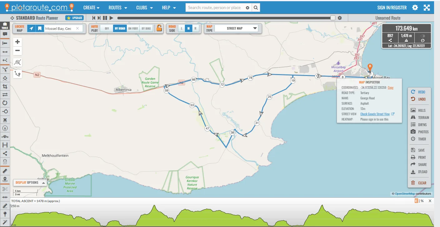
The team at SATriHub sat down and analysed the roads routes and terrain in Mosselbay and the surrounds to come up with some fun hypothetical route options.
Several things had to considered in our course creations.
- Road quality
- Elevation
- Time on national routes eg. Highways
- Amount of road double closure, meaning both sides
Route Option 1
In this route we head out the same way we would for the 70.3, instead of turning right past Mosdustria, we carry on straight on the N2 and turn left onto the Gouritsmond road. We head straight past Boggoms Bay and towards Johnson's post and over the Gourits River. Turn right at the T-junction and onto the R325 in a Northerly direction back to the N2 T-junction. Turn right on the N2 and cycle back towards the Gouritsmond road turn. This Gouritsmond loop is approximately 70km. Athletes turn right and complete this loop again before heading back to the De Bakke transition.
Elevation - 1548m (1 lap 180km course)
Our Rating - 8/10 Road condition is very good and there will only be road closures one side of the road for most of the route which makes sense for organisers. This ticks all the boxes for us but is an honest course.
Route Option 2
The same as route 1, we head out the same way we would for the 70.3, instead of turning right past Mosdustria, we carry on straight on the N2 and turn left onto the Gouritsmond road. We head straight past Boggoms Bay and towards Johnson's post and over the Gourits River. Turn right at the T-junction and onto the R325 in a Northerly direction back to the N2 T-junction. Turn right on the N2 and cycle back towards the Gouritsmond road turn. We carry on straight down the N2 and turn left at the Mosdustria turn R327 and head towards Herbertsdale the same as the 70.3 route, turnaround and come back the same as the 70.3 route
Elevation - 1561m (1 lap 180km course)
Our rating 6.5/10 Same as above, road condition is very good and there will only be road closures one side of the road for most of the route which makes sense for organisers. We think it might be a little too challenging.
Route Option 3
This route we would turn the opposite direction towards Langebaan mall and head straight on the R102 past Kleinbrak, Grootbrak and towards the George airport. Straight over Montague Street and turn by the George show grounds and head back the same way, this would be the same route as the new Garden Route triathlon but a 2 lap 90km course with a hefty elevation.
Our Rating - 5/10 Road condition would be the best of all 3, road closures would have to be both sides, there would be no part of the route on a national highway road, but the elevation would be the most of them all and we think it will be too hard for a full ironman.
Elevation - 1788m (2 lap 90km course)
Ultimately we might be completely wrong, they might do a route further down the N2 towards Albertina or we might have a shorter 3 lap course, but we know one thing for certain, its not going to be easy but it will be a beautiful breath taking course.